Laste ned presentasjonen
Presentasjon lastes. Vennligst vent

1
Geografiske informasjonssystemer (GIS) SGO1910 & SGO4930 Vår 2004 Foreleser: Karen O’Brien (karen.obrien@cicero.uio.no) Seminarleder: Gunnar Berglund (gunnarbe@student.sv.uio.no)
 SGO1910 & SGO4930 Vår 2004 Foreleser: Karen O’Brien Seminarleder: Gunnar Berglund")
2
Data Acquisition

3
Data Collection One of most expensive GIS activities One of most expensive GIS activities Many diverse sources Many diverse sources Two broad types of collection Two broad types of collection Data capture (direct collection) Data capture (direct collection) Data transfer Data transfer Two broad capture methods Two broad capture methods Primary (direct measurement) Primary (direct measurement) Secondary (indirect derivation) Secondary (indirect derivation)
 Data capture (direct collection) Data transfer Data transfer Two broad capture methods Two broad capture methods Primary (direct measurement) Primary (direct measurement) Secondary (indirect derivation) Secondary (indirect derivation)")
4
Data Collection Techniques RasterVector Primary Digital remote sensing images GPS measurements Digital aerial photographs Survey measurements Secondary Scanned maps Topographic surveys DEMs from maps Toponymy data sets from atlases

5
GEOCODING Geocoding is the conversion of spatial information into digital form. Geocoding is the conversion of spatial information into digital form. Geocoding involves capturing the map, and sometimes also capturing the attributes. Geocoding involves capturing the map, and sometimes also capturing the attributes.

6
Primary Data Capture Capture specifically for GIS use Capture specifically for GIS use Raster – remote sensing Raster – remote sensing e.g. SPOT and IKONOS satellites and aerial photography e.g. SPOT and IKONOS satellites and aerial photography Passive and active sensors Passive and active sensors Resolution is key consideration Resolution is key consideration Spatial Spatial Spectral Spectral Temporal Temporal

7
Secondary Geographic Data Capture Data collected for other purposes can be converted for use in GIS Data collected for other purposes can be converted for use in GIS Raster conversion Raster conversion Scanning of maps, aerial photographs, documents, etc Scanning of maps, aerial photographs, documents, etc Important scanning parameters are spatial and spectral (bit depth) resolution Important scanning parameters are spatial and spectral (bit depth) resolution
 resolution Important scanning parameters are spatial and spectral (bit depth) resolution")
8
Vector Primary Data Capture Surveying Surveying Locations of objects determines by angle and distance measurements from known locations Locations of objects determines by angle and distance measurements from known locations Uses expensive field equipment and crews Uses expensive field equipment and crews Most accurate method for large scale, small areas Most accurate method for large scale, small areas GPS GPS Collection of satellites used to fix locations on Earth’s surface Collection of satellites used to fix locations on Earth’s surface Differential GPS used to improve accuracy Differential GPS used to improve accuracy

9
Vector Secondary Data Capture Collection of vector objects from maps, photographs, plans, etc. Collection of vector objects from maps, photographs, plans, etc. Digitizing Digitizing Manual (table) Manual (table) Heads-up and vectorization Heads-up and vectorization Photogrammetry – the science and technology of making measurements from photographs, etc. Photogrammetry – the science and technology of making measurements from photographs, etc. COGO – Coordinate Geometry (land records and property lots – precise measurements: vector) COGO – Coordinate Geometry (land records and property lots – precise measurements: vector)
 Manual (table) Heads-up and vectorization Heads-up and vectorization Photogrammetry – the science and technology of making measurements from photographs, etc. Photogrammetry – the science and technology of making measurements from photographs, etc. COGO – Coordinate Geometry (land records and property lots – precise measurements: vector) COGO – Coordinate Geometry (land records and property lots – precise measurements: vector).")
10
Summary Data collection is very expensive, time-consuming, tedious and error prone Data collection is very expensive, time-consuming, tedious and error prone Good procedures required for large scale collection projects Good procedures required for large scale collection projects Main techniques Main techniques Primary Primary Raster – e.g. remote sensing Raster – e.g. remote sensing Vector – e.g. field survey Vector – e.g. field survey Secondary Secondary Raster – e.g. scanning Raster – e.g. scanning Vector – e.g. table digitizing Vector – e.g. table digitizing

11
Searching for georeferenced data First explore the Internet to find possible sources of data First explore the Internet to find possible sources of data Second, contact organizations or research institutions (kommuner, Statenskartverk, UNEP, etc.) Second, contact organizations or research institutions (kommuner, Statenskartverk, UNEP, etc.)
 Second, contact organizations or research institutions (kommuner, Statenskartverk, UNEP, etc.)")
13
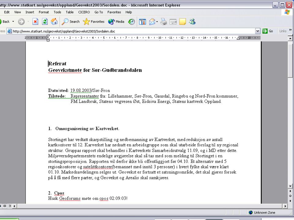
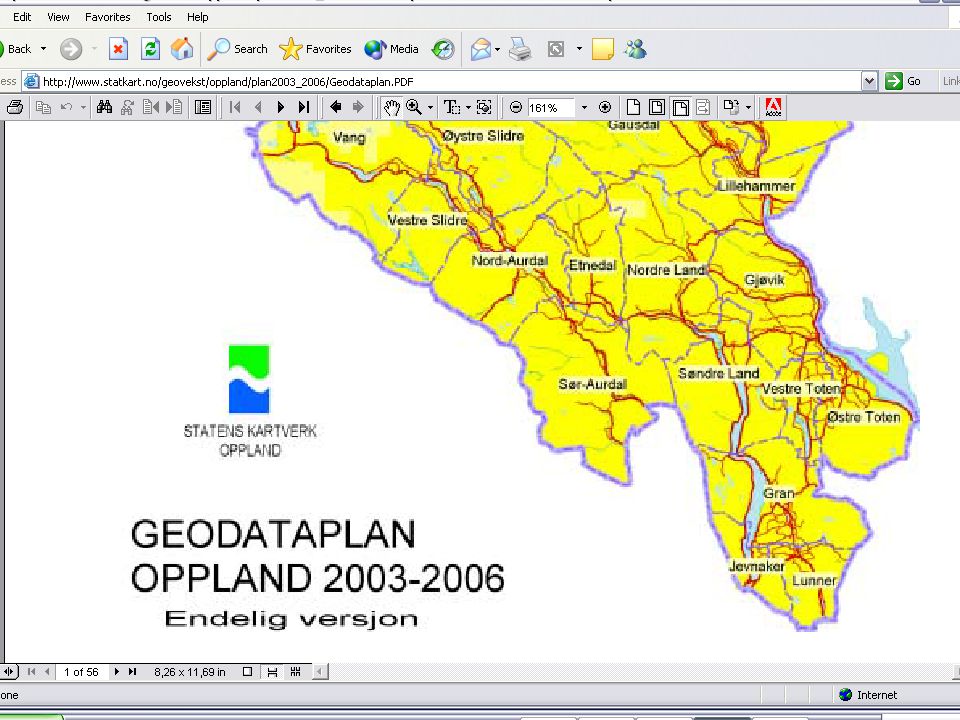
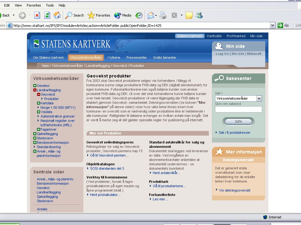
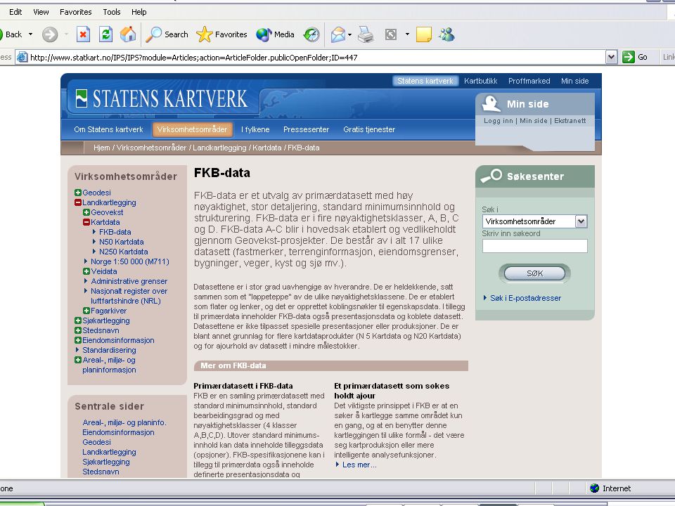
Example #1 Data for Sør Fron kommune Data for Sør Fron kommune

15
4. DEK 4. DEK Alle eiendomsgrenser fra ØK er nå ferdig digitalisert i Oppland, men det gjenstår mye når det gjelder digitalisering av kommunale data(gamle målebrev og lignende). Sluttkontroll er levert alle kommuner, og mange har en jobb å gjøre her! Det er mulig å forbedre DEK ved å kjøre diverse kontroller mot GAB, se vedlagte foiler. Ta kontakt med Kari Anne dersom noen trenger hjelp til å komme i gang, eller ønsker en hospiteringsordning. Telefon 61 26 62 13. Alle eiendomsgrenser fra ØK er nå ferdig digitalisert i Oppland, men det gjenstår mye når det gjelder digitalisering av kommunale data(gamle målebrev og lignende). Sluttkontroll er levert alle kommuner, og mange har en jobb å gjøre her! Det er mulig å forbedre DEK ved å kjøre diverse kontroller mot GAB, se vedlagte foiler. Ta kontakt med Kari Anne dersom noen trenger hjelp til å komme i gang, eller ønsker en hospiteringsordning. Telefon 61 26 62 13.
. Sluttkontroll er levert alle kommuner, og mange har en jobb å gjøre her. Det er mulig å forbedre DEK ved å kjøre diverse kontroller mot GAB, se vedlagte foiler. Ta kontakt med Kari Anne dersom noen trenger hjelp til å komme i gang, eller ønsker en hospiteringsordning. Telefon Alle eiendomsgrenser fra ØK er nå ferdig digitalisert i Oppland, men det gjenstår mye når det gjelder digitalisering av kommunale data(gamle målebrev og lignende). Sluttkontroll er levert alle kommuner, og mange har en jobb å gjøre her. Det er mulig å forbedre DEK ved å kjøre diverse kontroller mot GAB, se vedlagte foiler. Ta kontakt med Kari Anne dersom noen trenger hjelp til å komme i gang, eller ønsker en hospiteringsordning. Telefon")
23
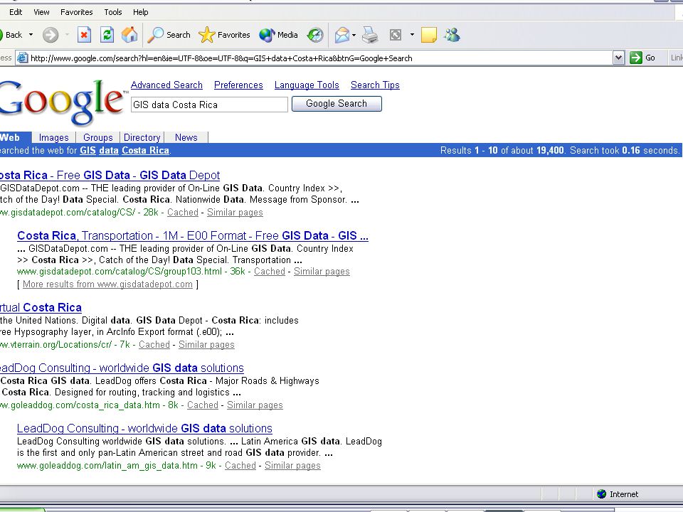
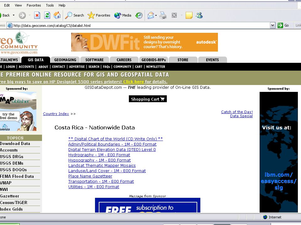
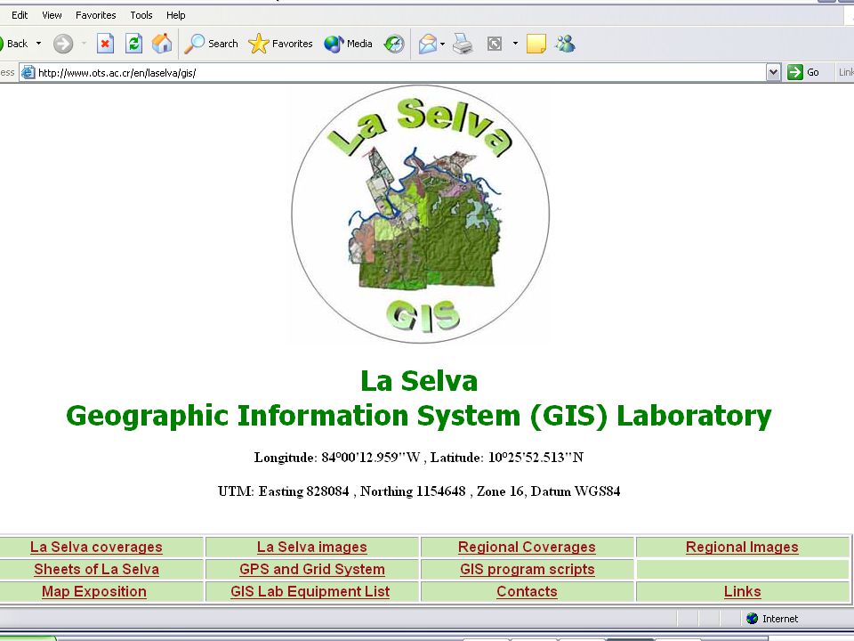
Example 2 Data for Costa Rica Data for Costa Rica

29
Challenge: Think about a place for which you would like to get georeferenced data, and do some searching on the Internet. Think about a place for which you would like to get georeferenced data, and do some searching on the Internet.

Liknende presentasjoner


>")


 happens in the database: : data.>")


